

Summary
- Google temporarily removed Nano Banana from Google Earth one day after its introduction
- Users created fake images of nuclear facilities, disasters, wars and refugee movements
- The generated scenes were based on real Google Earth coordinates and imagery
- SynthID could identify the original files, but some verification checks could be bypassed
- The images did not alter public Google Earth imagery and were visible only to their creators
- The feature will return after Google implements stronger safeguards
- The images that triggered the response
- Henk van Ess tests the tool
- Google’s response
- How SynthID was meant to help
- The images did not replace real Google Earth imagery
- How Nano Banana worked in Earth
- The uses originally presented by Google
- The risk to photographic credibility
- What we think
- Frequently asked questions
Google has temporarily removed Nano Banana from Google Earth after users created misleading images of real locations within hours, ranging from fake nuclear facilities to nonexistent disasters.
The feature was introduced on July 30, 2026, as a new way to generate images based on Google Earth’s satellite, aerial and 3D imagery. One day later, Google updated its announcement to confirm that it was rolling back the tool because images that appeared to violate its policies had already been shared.
The development is particularly significant because Google Earth has long been used as a reference for viewing real-world locations. The ability to generate photorealistic scenes on top of genuine geographic coordinates made it easier to create material that resembled authentic satellite imagery.
The images that triggered the response
Shortly after the feature became available, users began creating fake scenes based on real locations. Published examples included a toppled Eiffel Tower, nonexistent nuclear facilities in Iran, groups of refugees at the Mexico-United States border and planes appearing to crash into Manhattan skyscrapers.
Other generated images showed a hospital next to a bomb crater in Gaza, a fatal road accident in Amsterdam and additional fictional events that could be presented as real news imagery once removed from the original Google Earth environment.
Some creations were clearly fictional, such as Godzilla attacking a burning city. However, the main concern was not obviously entertaining material, but images that realistically depicted wars, disasters, refugee movements or sensitive military facilities.
Henk van Ess tests the tool
Digital misinformation expert Henk van Ess tested the feature by producing a series of images with potentially dangerous content. According to his published findings, the tool accepted prompts asking it to add a nuclear plant in Iran, refugees near the Mexican border, a hospital and bomb crater in Gaza and a fatal accident on an Amsterdam street.
The images were built on real visual material and precise Google Earth coordinates. As a result, the fictional elements were integrated into familiar buildings, roads and landscapes while retaining similar camera angles, lighting and colors to the authentic imagery.
Van Ess argued that this direct connection to the real environment increased the credibility of the fake images. A screenshot exported from the platform and shared without its original context could be mistaken for a genuine Google Earth capture.
Google’s response
Google acknowledged that people uniquely trust Google Earth as a reliable view of the world. Although geospatial professionals had already begun using the tool for useful applications, the company saw screenshots being shared that appeared to violate its policies.
It therefore decided to temporarily return the service to its previous state while developing stronger safeguards. Google did not provide a specific return date, but said Nano Banana would be restored to Earth after the new restrictions were implemented.
How SynthID was meant to help
Google emphasized that every image generated by Nano Banana in Google Earth included the SynthID digital watermark. Users could theoretically check a suspicious file through Gemini or Lens in Search to determine whether it had been created by Google’s artificial intelligence.
According to PetaPixel, BBC testing found that SynthID could recognize the original images generated in Google Earth. However, it was also possible to bypass some of the checks and cause Gemini to describe manipulated screenshots as real.
A community note attached to Google’s statement also claimed that SynthID may be embedded only in parts of the generated material, potentially allowing it to be bypassed through cropping or other modifications. Detection may also become more difficult when an image is reshared as a screenshot, a photograph of a screen or a compressed file.
The images did not replace real Google Earth imagery
The feature did not alter Google Earth’s public satellite or 3D imagery. Generated creations were displayed only to the user who submitted the prompt and were not added to the main Google Earth experience for other visitors to see.
The problem emerged when someone saved or photographed the result and shared it outside the service. At that point, the image could lose information about how it was created and appear on social networks or other platforms without the necessary context.
How Nano Banana worked in Earth
Users could navigate to any location on the planet through the web version of Google Earth, select the image-generation option and describe the scene they wanted to see.
Nano Banana used the real satellite, aerial and 3D imagery of the selected area as its starting point. It then generated a new composition that preserved the geographic shape and main features of the landscape.
This approach distinguished the tool from a conventional image generator because the result did not begin with a blank canvas. It was directly connected to a real point on the planet and could resemble an alternative version of an authentic geospatial image.
The uses originally presented by Google
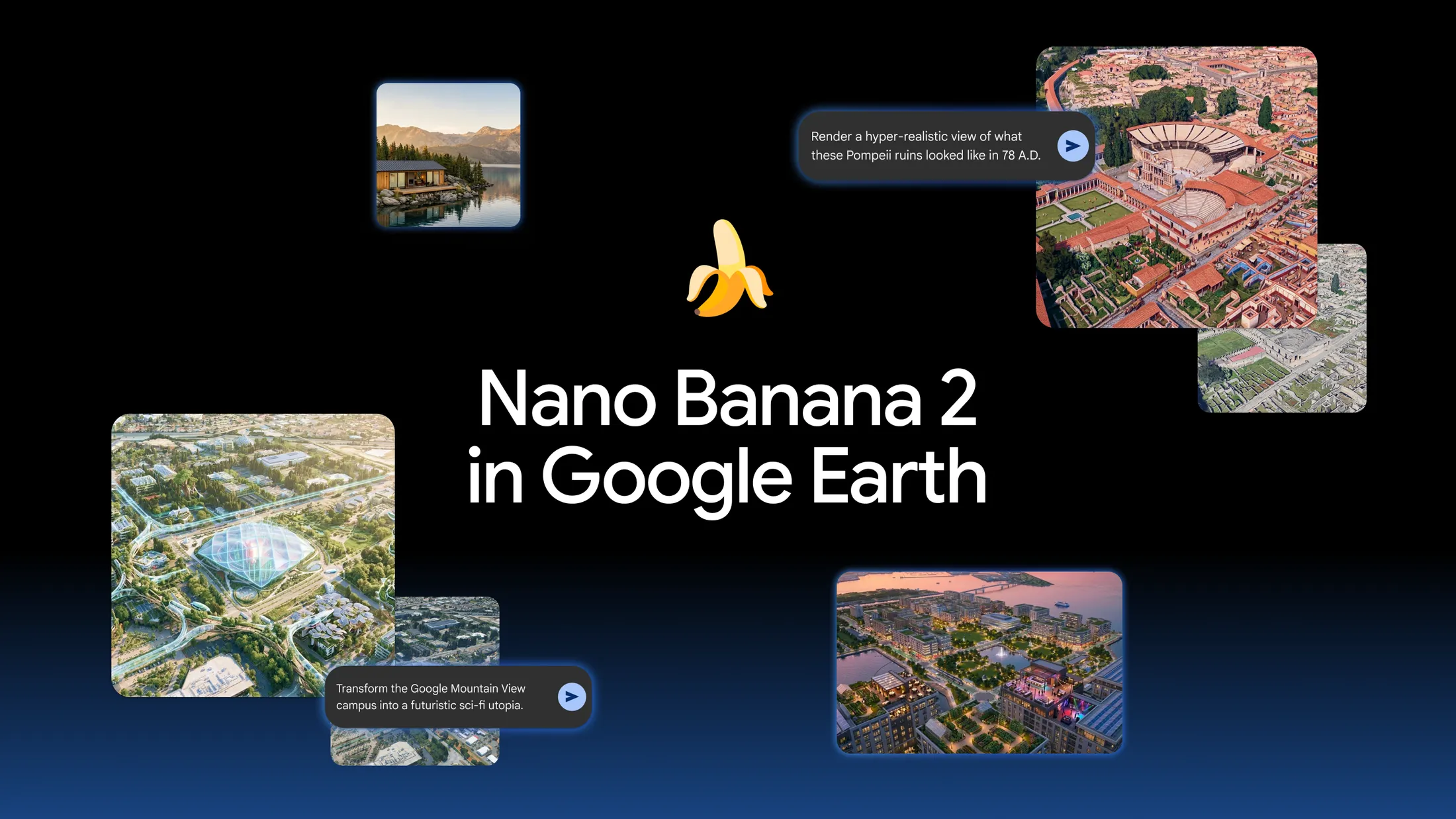
The first application involved reconstructing historical locations. Google used the ruins of Pompeii as an example, showing how they could be transformed into a photorealistic view of the city before its destruction.
A second use was the creation of educational infographics about historic landmarks. Gemini could collect information about a location, while Nano Banana turned it into visual material.
The tool was also intended for architects, urban planners and real estate professionals. An empty lot could be visualized as a shopping district, or an open space as a future housing development, providing an initial impression of a proposed project.
Individuals could visualize smaller construction projects, such as a backyard studio or a lakeside home. Google also suggested more creative uses, including transforming its present-day Mountain View campus into a futuristic city.
The risk to photographic credibility
Fake satellite images are not a new phenomenon, but integrating the generator directly into Google Earth significantly reduced the number of steps needed to create them. Users no longer had to export an image, move it into a separate application and perform complex editing.
The existence of these tools can also create the opposite problem: authentic images of real events may be dismissed as artificial intelligence. Uncertainty about an image’s origin can therefore be used both to spread fabricated events and to discredit genuine evidence.
What we think
Generating hypothetical imagery on top of real geospatial data could prove highly useful for education, architecture and project presentations. In the case of Google Earth, however, the platform’s credibility is a central part of its value. The temporary rollback was necessary because a watermark alone is insufficient when images can be cropped, photographed or reshared without their original context. Restoring the feature will require stricter restrictions around sensitive locations and events, visible labeling that survives exports and reliable verification methods beyond Google’s own ecosystem.
Frequently asked questions
Is Nano Banana still available in Google Earth?
No. Google temporarily removed the feature on July 31, 2026, one day after its original announcement.
Why was image generation removed?
Users created and shared misleading images of real locations that appeared to violate Google’s policies.
Did the images alter public Google Earth maps?
No. The results were not added to public Google Earth imagery and were not visible to other users.
What is SynthID?
SynthID is Google’s digital watermark for content generated by its artificial intelligence models. It can help determine the origin of an image, although testing indicated that verification was not impossible to bypass.
When will the feature return?
Google has not announced a date. It has said the tool will return after stronger safeguards are implemented.