

Summary
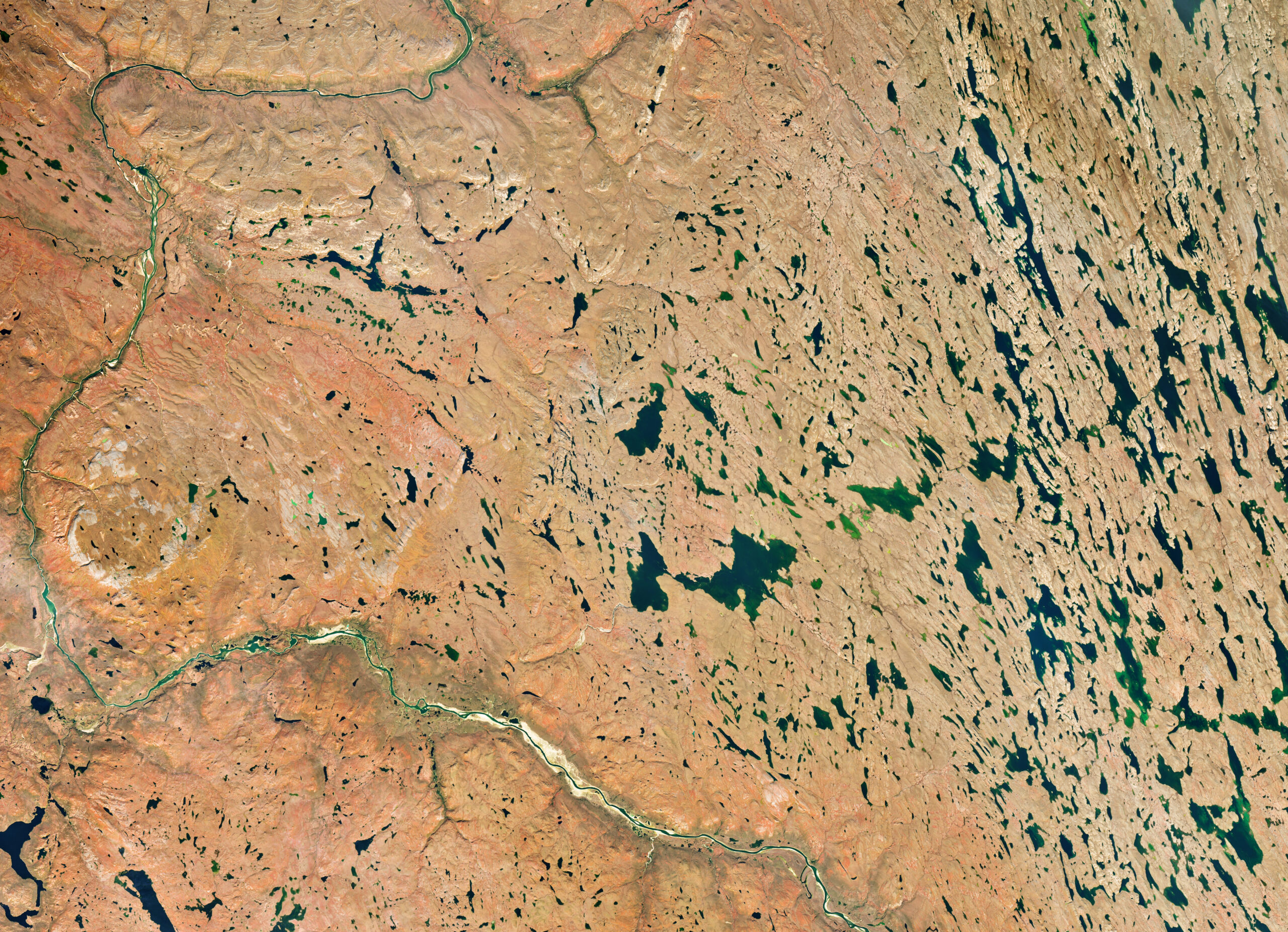
- Landsat 9 imaged the same area of Nunavut on July 27 and September 6, 2026.
- Vegetation changed from vivid green to red, orange and yellow hues.
- In far northern regions, peak fall color can last just a week or less.
Fall has already reached northern Canada, and NASA satellite imagery shows just how quickly the landscape can change.
Landsat 9 captured the same area along the Coppermine River near Kugluktuk, Nunavut, on July 27 and again on September 6, 2026. The first image is dominated by green, while the second shows the tundra transformed into a mosaic of red, orange and yellow.
The change in just 41 days
The two views were acquired by Landsat 9’s OLI (Operational Land Imager). NASA says the region is covered by low-growing tundra vegetation including willow and birch shrubs, blueberries and bearberries, which change color each fall.
An analysis of seven years of satellite data by NASA and South Dakota State University found that foliage in the region usually begins changing in early September and peaks around the middle of the month, making Nunavut one of the first parts of North America to show fall color.
Why red, orange and yellow appear
As days shorten and temperatures fall, plants produce less chlorophyll, the pigment responsible for their green color. As green fades, other pigments such as carotenoids and anthocyanins become more visible, producing yellow, orange and red hues.
In far northern regions, however, peak color can be extremely brief. NASA notes that in some places it can last a week or less.
What we think
The comparison is a striking example of how satellite photography can turn a seasonal change into immediately readable visual data. The matching geography and viewpoint make the 41-day transformation especially clear.
Frequently asked questions
When were the two images captured?
On July 27 and September 6, 2026.
Which satellite captured them?
Landsat 9, using the OLI (Operational Land Imager).
Where is the area?
Along the Coppermine River, upriver of Kugluktuk in Nunavut, northern Canada.
How long can peak fall color last there?
In far northern areas, it can last only a week or less.